
Mapping/GIS
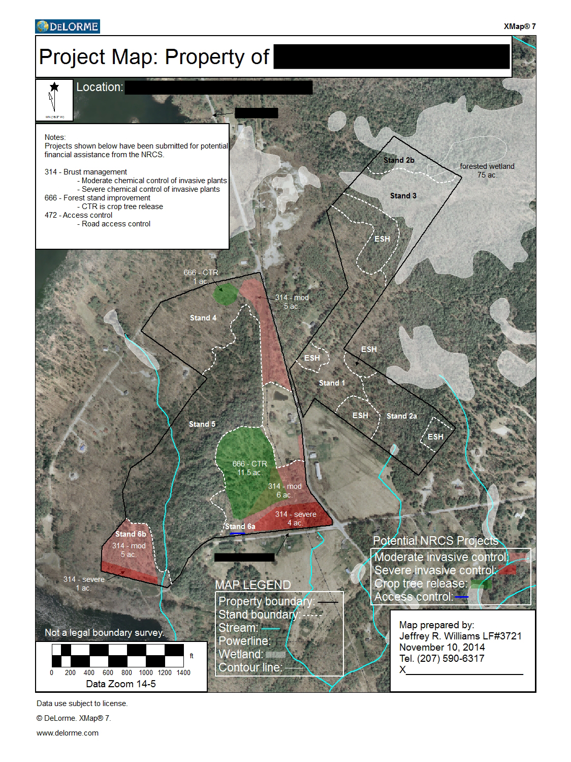
We take pride in providing landowners with high quality maps of their property and consider it to be an essential management tool. Maps can be prepared with a variety of base data including the most up-to-date aerial imagery, satellite imagery, and USGS 7.5 minute quads. We offer leaf-off or leaf-on imagery to distinguish the difference between softwood and hardwood.